
Vettweiß topographic map
Interactive map
Click on the map to display elevation.
About this map
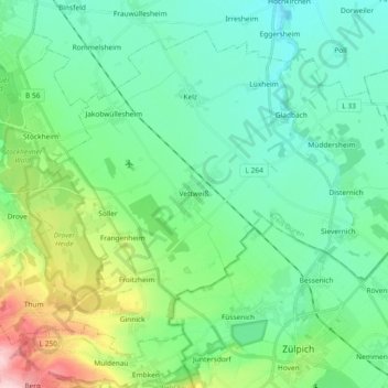
Name: Vettweiß topographic map, elevation, terrain.
Location: Vettweiß, Kreis Düren, Noordrijn-Westfalen, 52391, Duitsland (50.68941 6.51821 50.78800 6.70268)
Average elevation: 541 ft
Minimum elevation: 371 ft
Maximum elevation: 1,089 ft