
City of Sanford topographic map
Interactive map
Click on the map to display elevation.
About this map
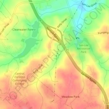
Name: City of Sanford topographic map, elevation, terrain.
Location: City of Sanford, Lee County, North Carolina, United States (35.47723 -79.13555 35.47955 -79.13150)
Average elevation: 377 ft
Minimum elevation: 246 ft
Maximum elevation: 466 ft