
Çayköy topographic map
Interactive map
Click on the map to display elevation.
About this map
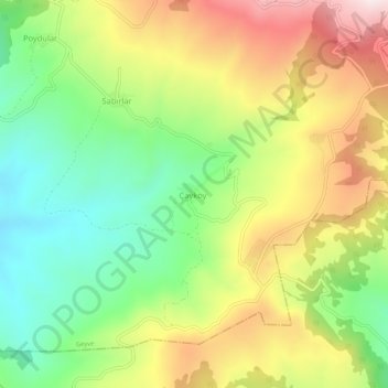
Name: Çayköy topographic map, elevation, terrain.
Location: Çayköy, Geyve, Sakarya, Marmara Region, Turkey (40.43723 30.42757 40.47723 30.46757)
Average elevation: 2,418 ft
Minimum elevation: 1,617 ft
Maximum elevation: 3,448 ft