
Thank you for supporting this site ❤️
Make a donation
Make a donation
Gear up for your next adventure:
As an Amazon Associate, this site earns from qualifying purchases at no extra cost to you.
Moniquirá topographic map
Click on the map to display elevation.
Thank you for supporting this site ❤️
Make a donation
Make a donation
Gear up for your next adventure:
As an Amazon Associate, this site earns from qualifying purchases at no extra cost to you.
About this map
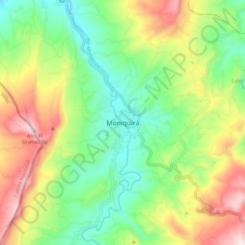
Name: Moniquirá topographic map, elevation, terrain.
Location: Moniquirá, Ricaurte, Boyacá, 154290, Colombia (5.83631 -73.61321 5.91631 -73.53321)
Average elevation: 6,083 ft
Minimum elevation: 5,328 ft
Maximum elevation: 7,267 ft
Thank you for supporting this site ❤️
Make a donation
Make a donation
Gear up for your next adventure:
As an Amazon Associate, this site earns from qualifying purchases at no extra cost to you.