
Locorotondo topographic map
Interactive map
Click on the map to display elevation.
About this map
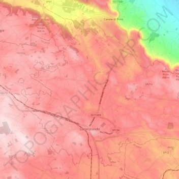
Name: Locorotondo topographic map, elevation, terrain.
Location: Locorotondo, BA, Pouilles, Italie (40.73751 17.28093 40.81260 17.40055)
Average elevation: 1,152 ft
Minimum elevation: 312 ft
Maximum elevation: 1,457 ft