
Thank you for supporting this site ❤️
Make a donation
Make a donation
Gear up for your next adventure:
As an Amazon Associate, this site earns from qualifying purchases at no extra cost to you.
Döbeln topographic map
Click on the map to display elevation.
Thank you for supporting this site ❤️
Make a donation
Make a donation
Gear up for your next adventure:
As an Amazon Associate, this site earns from qualifying purchases at no extra cost to you.
About this map
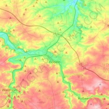
Name: Döbeln topographic map, elevation, terrain.
Location: Döbeln, Mittelsachsen, Saxony, 04720, Germany (51.07827 13.01379 51.17577 13.25907)
Average elevation: 751 ft
Minimum elevation: 466 ft
Maximum elevation: 1,063 ft
Thank you for supporting this site ❤️
Make a donation
Make a donation
Gear up for your next adventure:
As an Amazon Associate, this site earns from qualifying purchases at no extra cost to you.