
Thank you for supporting this site ❤️
Make a donation
Make a donation
Gear up for your next adventure:
As an Amazon Associate, this site earns from qualifying purchases at no extra cost to you.
Heiligenhafen topographic map
Click on the map to display elevation.
Thank you for supporting this site ❤️
Make a donation
Make a donation
Gear up for your next adventure:
As an Amazon Associate, this site earns from qualifying purchases at no extra cost to you.
About this map
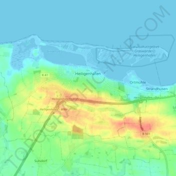
Name: Heiligenhafen topographic map, elevation, terrain.
Location: Heiligenhafen, Ostholstein, Schleswig-Holstein, 23774, Germany (54.34899 10.92265 54.38478 11.02338)
Average elevation: 46 ft
Minimum elevation: -16 ft
Maximum elevation: 187 ft
Thank you for supporting this site ❤️
Make a donation
Make a donation
Gear up for your next adventure:
As an Amazon Associate, this site earns from qualifying purchases at no extra cost to you.