
Nuevo Lajas topographic map
Interactive map
Click on the map to display elevation.
About this map
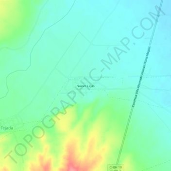
Name: Nuevo Lajas topographic map, elevation, terrain.
Location: Nuevo Lajas, Buenaventura, Chihuahua, México (30.02819 -106.94250 30.06819 -106.90250)
Average elevation: 4,577 ft
Minimum elevation: 4,508 ft
Maximum elevation: 4,764 ft