
Saint Gréé topographic map
Interactive map
Click on the map to display elevation.
About this map
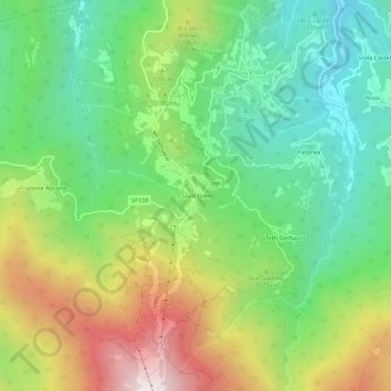
Name: Saint Gréé topographic map, elevation, terrain.
Location: Saint Gréé, Viola, Cuneo, Piemonte, Italia (44.25805 7.93773 44.29805 7.97773)
Average elevation: 3,330 ft
Minimum elevation: 1,952 ft
Maximum elevation: 5,640 ft