
Alpthal topographic map
Interactive map
Click on the map to display elevation.
About this map
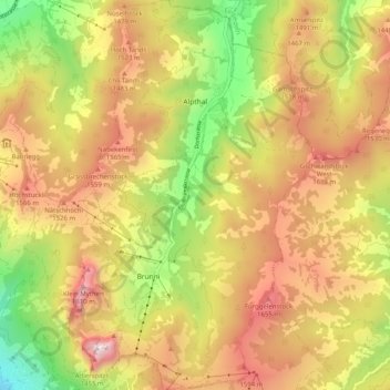
Name: Alpthal topographic map, elevation, terrain.
Location: Alpthal, Schwyz, 8849, Schweiz (47.02245 8.68641 47.09136 8.74468)
Average elevation: 4,236 ft
Minimum elevation: 2,149 ft
Maximum elevation: 6,168 ft
Other topographic maps
Click on a map to view its topography, its elevation and its terrain.
Fronalpstock
Schweiz > Schwyz > Schwyz > Morschach
Fronalpstock, Morschach, Schwyz, 6443, Schweiz
Average elevation: 4,354 ft