
Thank you for supporting this site ❤️
Make a donation
Make a donation
Gear up for your next adventure:
As an Amazon Associate, this site earns from qualifying purchases at no extra cost to you.
Jebala topographic map
Click on the map to display elevation.
Thank you for supporting this site ❤️
Make a donation
Make a donation
Gear up for your next adventure:
As an Amazon Associate, this site earns from qualifying purchases at no extra cost to you.
About this map
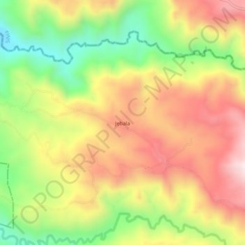
Name: Jebala topographic map, elevation, terrain.
Location: Jebala, Totoró, Oriente, Cauca, RAP Pacífico, Colombie (2.57050 -76.49527 2.61050 -76.45527)
Average elevation: 7,287 ft
Minimum elevation: 6,198 ft
Maximum elevation: 8,320 ft
Thank you for supporting this site ❤️
Make a donation
Make a donation
Gear up for your next adventure:
As an Amazon Associate, this site earns from qualifying purchases at no extra cost to you.