
Kampur topographic map
Interactive map
Click on the map to display elevation.
About this map
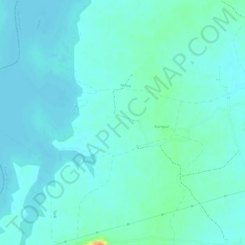
Name: Kampur topographic map, elevation, terrain.
Location: Kampur, Raisen Tahsil, Raisen District, Madhya Pradesh, India (23.44042 77.50143 23.44794 77.51710)
Average elevation: 1,516 ft
Minimum elevation: 1,490 ft
Maximum elevation: 1,614 ft
Other topographic maps
Click on a map to view its topography, its elevation and its terrain.
Raisen Fort
India > Madhya Pradesh > Raisen Tahsil > Raisen
Raisen Fort, NH146, Raisen, Raisen Tahsil, Raisen, Madhya Pradesh, 464551, India
Average elevation: 1,499 ft