
Alba topographic map
Interactive map
Click on the map to display elevation.
About this map
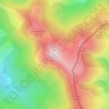
Name: Alba topographic map, elevation, terrain.
Location: Alba, Baztan, Navarre, Spain (43.09087 -1.47908 43.09097 -1.47898)
Average elevation: 2,490 ft
Minimum elevation: 1,427 ft
Maximum elevation: 3,451 ft
Other topographic maps
Click on a map to view its topography, its elevation and its terrain.