
Penang National Park topographic map
Interactive map
Click on the map to display elevation.
About this map
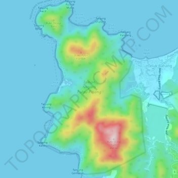
Name: Penang National Park topographic map, elevation, terrain.
Average elevation: 243 ft
Minimum elevation: -3 ft
Maximum elevation: 1,496 ft
Other topographic maps
Click on a map to view its topography, its elevation and its terrain.
Pantai Aceh
Malásia > PNG > Pantai Aceh
Pantai Aceh, Barat Daya, PNG, 11050, Malásia
Average elevation: 240 ft