
Auesee topographic map
Interactive map
Click on the map to display elevation.
About this map
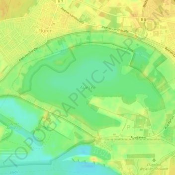
Name: Auesee topographic map, elevation, terrain.
Location: Auesee, Wesel, Kreis Wesel, Nordrhein-Westfalen, Deutschland (51.66574 6.56760 51.67884 6.60185)
Average elevation: 66 ft
Minimum elevation: 20 ft
Maximum elevation: 98 ft
Other topographic maps
Click on a map to view its topography, its elevation and its terrain.
Bergerfurth
Deutschland > Nordrhein-Westfalen > Kreis Wesel > Wesel
Bergerfurth, Bislich, Wesel, Kreis Wesel, Nordrhein-Westfalen, Deutschland
Average elevation: 69 ft
Büderich
Deutschland > Nordrhein-Westfalen > Kreis Wesel > Wesel
Büderich, Wesel, Kreis Wesel, Nordrhein-Westfalen, Deutschland
Average elevation: 66 ft