
Niedermohr topographic map
Interactive map
Click on the map to display elevation.
About this map
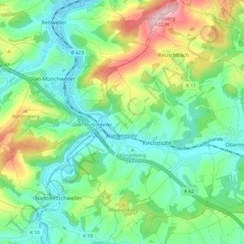
Name: Niedermohr topographic map, elevation, terrain.
Average elevation: 915 ft
Minimum elevation: 686 ft
Maximum elevation: 1,427 ft
Other topographic maps
Click on a map to view its topography, its elevation and its terrain.
Oberhammer
Duitsland > Rijnland-Palts > Landkreis Kaiserslautern > Trippstadt
Oberhammer, Trippstadt, Landstuhl, Landkreis Kaiserslautern, Rijnland-Palts, 67705, Duitsland
Average elevation: 1,293 ft
Ramstein-Miesenbach
Duitsland > Rijnland-Palts > Landkreis Kaiserslautern
Ramstein-Miesenbach, Landkreis Kaiserslautern, Rijnland-Palts, 66877, Duitsland
Average elevation: 873 ft