
Canudos topographic map
Interactive map
Click on the map to display elevation.
About this map
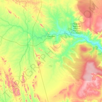
Name: Canudos topographic map, elevation, terrain.
Average elevation: 1,640 ft
Minimum elevation: 1,001 ft
Maximum elevation: 2,822 ft
Das historische Canudos liegt heute auf dem Grund eines Stausees. Die heutige Ortschaft Canudos befindet sich einige hundert Meter höher.