
Tielt-Winge topographic map
Interactive map
Click on the map to display elevation.
About this map
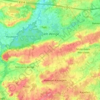
Name: Tielt-Winge topographic map, elevation, terrain.
Location: Tielt-Winge, Flemish Brabant, Flanders, Belgium (50.88027 4.84295 50.96323 4.95183)
Average elevation: 177 ft
Minimum elevation: 56 ft
Maximum elevation: 318 ft