
Coutisse topographic map
Interactive map
Click on the map to display elevation.
About this map
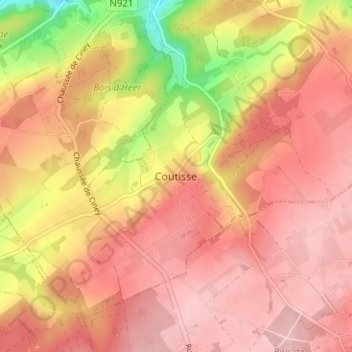
Name: Coutisse topographic map, elevation, terrain.
Location: Coutisse, Andenne, Namur, Wallonie, 5300, Belgique (50.44366 5.09696 50.48366 5.13696)
Average elevation: 722 ft
Minimum elevation: 325 ft
Maximum elevation: 912 ft
Other topographic maps
Click on a map to view its topography, its elevation and its terrain.