
Castelldefels topographic map
Interactive map
Click on the map to display elevation.
About this map
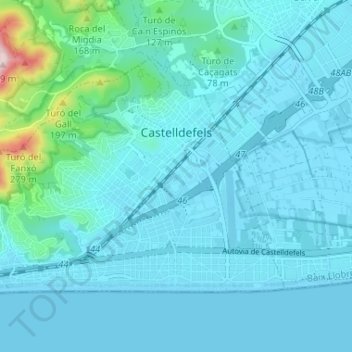
Name: Castelldefels topographic map, elevation, terrain.
Location: Castelldefels, Baix Llobregat, Barcelona, 08860, Spain (41.26341 1.93725 41.29660 2.00238)
Average elevation: 115 ft
Minimum elevation: -3 ft
Maximum elevation: 1,152 ft