
Marmagne topographic map
Interactive map
Click on the map to display elevation.
About this map
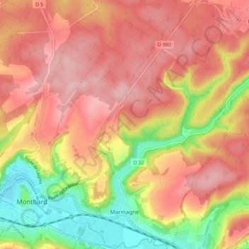
Name: Marmagne topographic map, elevation, terrain.
Average elevation: 1,004 ft
Minimum elevation: 673 ft
Maximum elevation: 1,217 ft
Other topographic maps
Click on a map to view its topography, its elevation and its terrain.
Planay
Frankreich > Burgund und Freigrafschaft > Côte-d'Or
Planay, Montbard, Côte-d'Or, Burgund und Freigrafschaft, Metropolitanes Frankreich, 21500, Frankreich
Average elevation: 1,004 ft