
包公园 topographic map
Interactive map
Click on the map to display elevation.
About this map
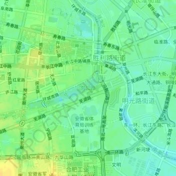
Name: 包公园 topographic map, elevation, terrain.
Location: 包公园, 包公街道, 包河区, 合肥市, 安徽省, 中国 (31.85650 117.28087 31.86409 117.29557)
Average elevation: 59 ft
Minimum elevation: 26 ft
Maximum elevation: 102 ft
Other topographic maps
Click on a map to view its topography, its elevation and its terrain.