Geolocate

Zittau topographic map

Click on the map to display elevation.

About this map

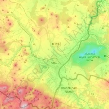
Name: Zittau topographic map, elevation, terrain.

Location: Zittau, Bertsdorf-Hörnitz, Görlitz, Saxony, Germany (50.81996 14.75506 50.99958 14.90693)

Average elevation: 1,060 ft

Minimum elevation: 125 ft

Maximum elevation: 2,385 ft

Gear up for your next adventure:

🧦Merino Wool Socks - Moisture-wicking, blister-preventing socks for long treks
🎒Trail Energy Bars - High‑calorie bars for hiking energy
🛰️Handheld GPS Units - Professional satellite navigators for precise backcountry mapping
🩳Quick‑Dry Hiking Shorts - Comfortable and quick‑dry shorts for summer hiking
🧭Hiking Compass - Precision compass for reliable navigation in the wilderness

As an Amazon Associate, this site earns from qualifying purchases at no extra cost to you.