
Thank you for supporting this site ❤️
Make a donation
Make a donation
Gear up for your next adventure:
As an Amazon Associate, this site earns from qualifying purchases at no extra cost to you.
Tajumulco topographic map
Click on the map to display elevation.
Thank you for supporting this site ❤️
Make a donation
Make a donation
Gear up for your next adventure:
As an Amazon Associate, this site earns from qualifying purchases at no extra cost to you.
About this map
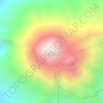
Name: Tajumulco topographic map, elevation, terrain.
Location: Tajumulco, San Marcos, Guatemala (15.04305 -91.90366 15.04315 -91.90356)
Average elevation: 11,890 ft
Minimum elevation: 10,033 ft
Maximum elevation: 13,825 ft
Thank you for supporting this site ❤️
Make a donation
Make a donation
Gear up for your next adventure:
As an Amazon Associate, this site earns from qualifying purchases at no extra cost to you.