
Lac de la Gileppe topographic map
Interactive map
Click on the map to display elevation.
About this map
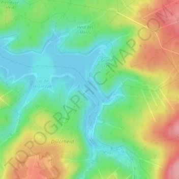
Name: Lac de la Gileppe topographic map, elevation, terrain.
Average elevation: 1,132 ft
Minimum elevation: 974 ft
Maximum elevation: 1,378 ft
Other topographic maps
Click on a map to view its topography, its elevation and its terrain.
Fossé d'Eupen
Fossé d'Eupen, Baelen, Verviers, Liège, Wallonie, 4837, Belgique
Average elevation: 1,857 ft