
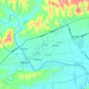
桂花村 topographic map
Interactive map
Click on the map to display elevation.
About this map
Name: 桂花村 topographic map, elevation, terrain.
Location: 桂花村, 新昌镇, 宜丰县, 宜春市, 江西省, 中国 (28.37372 114.76255 28.41372 114.80255)
Average elevation: 292 ft
Minimum elevation: 180 ft
Maximum elevation: 610 ft
Other topographic maps
Click on a map to view its topography, its elevation and its terrain.