
Tarija topographic map
Interactive map
Click on the map to display elevation.
About this map
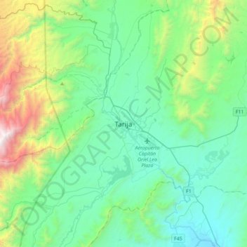
Name: Tarija topographic map, elevation, terrain.
Location: Tarija, Provincia Cercado, Tarija, TAR, Bolivie (-21.69407 -64.89442 -21.37407 -64.57442)
Average elevation: 7,238 ft
Minimum elevation: 5,466 ft
Maximum elevation: 13,898 ft