Geolocate

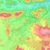
Olot topographic map

Click on the map to display elevation.

About this map
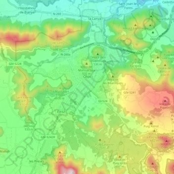
Name: Olot topographic map, elevation, terrain.

Location: Olot, Garrotxa, Girona, Catalonia, Spain (42.14974 2.44638 42.20532 2.54909)

Average elevation: 1,637 ft

Minimum elevation: 961 ft

Maximum elevation: 2,890 ft

Other topographic maps

Click on a map to view its topography, its elevation and its terrain.

Llongarriu

Spain > Catalonia > Garrotxa > la Vall de Bianya

Average elevation: 2,290 ft

Olot

Spain > Catalonia > Garrotxa > Olot > Olot

Average elevation: 1,604 ft

Serrat dels Boixos

Spain > Catalonia > Garrotxa > Montagut i Oix > Oix

Average elevation: 2,254 ft

Besalú

Spain > Catalonia > Garrotxa > Besalú > Besalú

Average elevation: 738 ft

Pallerols

Spain > Catalonia > Garrotxa > Sant Feliu de Pallerols

Average elevation: 1,995 ft

Sant Esteve d'en Bas

Spain > Catalonia > Garrotxa > la Vall d'en Bas

Average elevation: 1,837 ft

Gear up for your next adventure:

🛠️Outdoor Gear Repair Kit - Essential tools to fix gear on the trail
🛏️Cold Weather Sleeping Bag - Warm sleeping bag for cold conditions
❄️Traction Cleats - Prevent slips on icy trails during winter hikes
🔥Plasma Lighters - Windproof lighters that work in any weather condition
🛌Ultralight Sleeping Bags - Compact down bags for cold nights in the wilderness

As an Amazon Associate, this site earns from qualifying purchases at no extra cost to you.