
Kutno topographic map
Interactive map
Click on the map to display elevation.
About this map
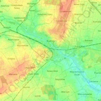
Name: Kutno topographic map, elevation, terrain.
Location: Kutno, Landkreis Kutno, Woiwodschaft Lodz, Polen (52.19097 19.28941 52.25359 19.45287)
Average elevation: 377 ft
Minimum elevation: 318 ft
Maximum elevation: 446 ft
Other topographic maps
Click on a map to view its topography, its elevation and its terrain.
Witów
Polen > Woiwodschaft Lodz > Landkreis Kutno
Witów, gmina Krośniewice, Landkreis Kutno, Woiwodschaft Lodz, 99-340, Polen
Average elevation: 387 ft