Geolocate

Raigad Fort topographic map

Click on the map to display elevation.

About this map
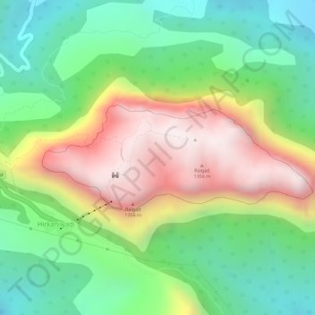
Name: Raigad Fort topographic map, elevation, terrain.

Location: Raigad Fort, Raigad Fort Trail, Hirkaniwadi, Mahad Taluka, Raigad, Maharashtra, 402104, India (18.23072 73.43435 18.23979 73.45876)

Average elevation: 1,476 ft

Minimum elevation: 423 ft

Maximum elevation: 2,841 ft

Other topographic maps

Click on a map to view its topography, its elevation and its terrain.

Raigad

India > Maharashtra > Mahad Taluka > Hirkaniwadi

Average elevation: 1,444 ft

Gear up for your next adventure:

🧴Hand Sanitizer - Keep hands clean while hiking
☀️Outdoor Sunscreen - High protection sunscreen for outdoor activities
🎒Day Hiking Backpack - Lightweight backpack perfect for day trips and outdoor adventures
📶Satellite Messenger - Communication device off‑grid
🌎3D Topographic Globes - Raised relief globes for a tactile understanding of geography

As an Amazon Associate, this site earns from qualifying purchases at no extra cost to you.