
港坞 topographic map
Interactive map
Click on the map to display elevation.
About this map
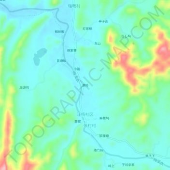
Name: 港坞 topographic map, elevation, terrain.
Location: 港坞, 汪杨社区, 德兴市, 上饶市, 江西省, 中国 (28.74819 117.53655 28.78819 117.57655)
Average elevation: 318 ft
Minimum elevation: 174 ft
Maximum elevation: 771 ft