
Laghouat topographic map
Interactive map
Click on the map to display elevation.
About this map
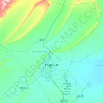
Name: Laghouat topographic map, elevation, terrain.
Location: Laghouat, Laghouat District, Laghouat, Algeria (33.70405 2.71798 33.98088 3.04302)
Average elevation: 2,730 ft
Minimum elevation: 2,388 ft
Maximum elevation: 4,590 ft
Other topographic maps
Click on a map to view its topography, its elevation and its terrain.