
Vda. Los Naranjos topographic map
Interactive map
Click on the map to display elevation.
About this map
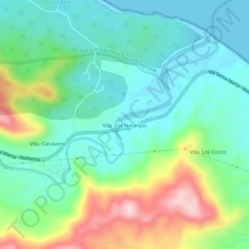
Name: Vda. Los Naranjos topographic map, elevation, terrain.
Location: Vda. Los Naranjos, Santa Marta, Magdalena, 55555, Colombia (11.26268 -73.92676 11.30268 -73.88676)
Average elevation: 305 ft
Minimum elevation: 0 ft
Maximum elevation: 1,040 ft