
Chevry topographic map
Interactive map
Click on the map to display elevation.
About this map
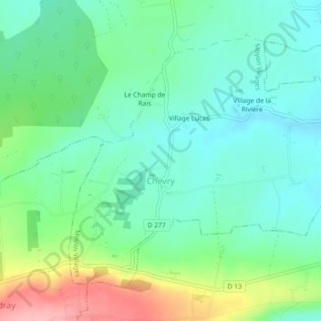
Name: Chevry topographic map, elevation, terrain.
Average elevation: 338 ft
Minimum elevation: 213 ft
Maximum elevation: 643 ft
Other topographic maps
Click on a map to view its topography, its elevation and its terrain.
Moyon
France > Normandie > Manche > Moyon Villages
Moyon, Moyon Villages, Saint-Lô, Manche, Normandie, France métropolitaine, 50860, France
Average elevation: 328 ft
Village Montigny
France > Normandie > Manche > Moyon Villages > Moyon > Village Montigny
Village Montigny, Moyon, Moyon Villages, Saint-Lô, Manche, Normandie, France métropolitaine, 50860, France
Average elevation: 381 ft