
Dana Biosphere Reserve topographic map
Interactive map
Click on the map to display elevation.
About this map
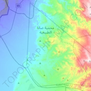
Name: Dana Biosphere Reserve topographic map, elevation, terrain.
Location: Dana Biosphere Reserve, Tafilah, Jordan (30.62299 35.38971 30.82722 35.64115)
Average elevation: 728 ft
Minimum elevation: -820 ft
Maximum elevation: 4,416 ft
Other topographic maps
Click on a map to view its topography, its elevation and its terrain.
Al Ain al Bayda
Jordan > Tafilah > At Tafila Sub-District
Al Ain al Bayda, At Tafila Sub-District, Tafilah Qasabah District, Tafilah, Jordan
Average elevation: 3,793 ft
Al Qurayqarah
Jordan > Tafilah > Al Qurayqarah
Al Qurayqarah, Tafilah, Jordan
Average elevation: 361 ft