
Estépar topographic map
Interactive map
Click on the map to display elevation.
About this map
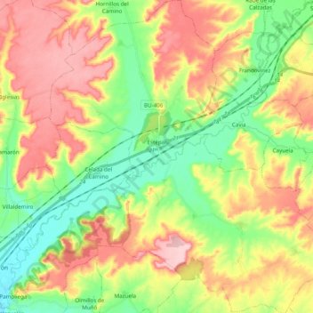
Name: Estépar topographic map, elevation, terrain.
Location: Estépar, Burgos, Castilië en León, Spanje (42.19857 -3.96497 42.34175 -3.78857)
Average elevation: 2,822 ft
Minimum elevation: 2,556 ft
Maximum elevation: 3,143 ft