Geolocate

Velingrad topographic map

Click on the map to display elevation.

About this map

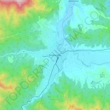
Name: Velingrad topographic map, elevation, terrain.

Location: Velingrad, Pazardzhik, 4600, Bulgaria (41.98836 23.95444 42.06836 24.03444)

Average elevation: 2,907 ft

Minimum elevation: 2,375 ft

Maximum elevation: 5,059 ft

Gear up for your next adventure:

👓Polarized Sunglasses - Outdoor sunglasses for glare reduction
🎒Trekking Poles - Sturdy poles for balance and stability on rough terrain
🧦Merino Wool Socks - Moisture-wicking, blister-preventing socks for long treks
📻Weather Alert Radios - Stay informed of storm risks while off-the-grid
🎒Trail Energy Bars - High‑calorie bars for hiking energy

As an Amazon Associate, this site earns from qualifying purchases at no extra cost to you.