
Waupaca topographic map
Interactive map
Click on the map to display elevation.
About this map
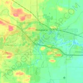
Name: Waupaca topographic map, elevation, terrain.
Location: Waupaca, Waupaca County, Wisconsin, United States (44.31564 -89.13670 44.37387 -89.00603)
Average elevation: 876 ft
Minimum elevation: 787 ft
Maximum elevation: 1,060 ft