
Make a donation
Gear up for your next adventure:
As an Amazon Associate, this site earns from qualifying purchases at no extra cost to you.
Secëda - Monte Seceda topographic map
Click on the map to display elevation.
Make a donation
Gear up for your next adventure:
As an Amazon Associate, this site earns from qualifying purchases at no extra cost to you.
Secëda - Monte Seceda
Monte Seceda is a 2,519-meter-elevation (8,264-foot) summit in the Odles Group of the Dolomites, a UNESCO World Heritage Site. Set in the Trentino-Alto Adige/Südtirol region, the peak is located four kilometers (2.5 miles) north of the village of Santa Cristina Gherdëina, and the peak is in Puez-Geisler Nature Park. Precipitation runoff from the mountain's northeast slope drains into Rio Funes, whereas the other slopes drain into tributaries of the Derjon. Topographic relief is significant as the summit rises 1,200 meters (3,937 feet) above Val Gardena in four kilometers (2.5 miles). The nearest higher neighbor is Untere Fermeda, 1.32 kilometers (0.82 mile) to the east. A gondola lifts tourists from the town of Urtijëi up to the slopes of Seceda where trails await to enjoy spectacular scenery such as views of Grande Fermeda, and providing one of the most dramatic experiences in the Dolomites.
Make a donation
Gear up for your next adventure:
As an Amazon Associate, this site earns from qualifying purchases at no extra cost to you.
About this map
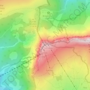
Name: Secëda - Monte Seceda topographic map, elevation, terrain.
Average elevation: 6,909 ft
Minimum elevation: 5,623 ft
Maximum elevation: 8,366 ft
Make a donation
Gear up for your next adventure:
As an Amazon Associate, this site earns from qualifying purchases at no extra cost to you.