
Los Tilos topographic map
Interactive map
Click on the map to display elevation.
About this map
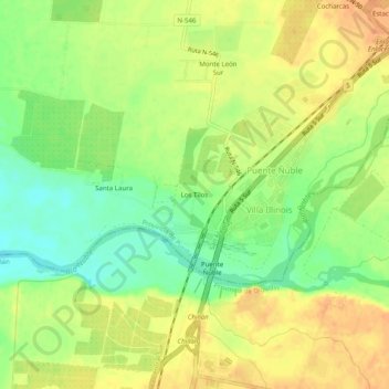
Name: Los Tilos topographic map, elevation, terrain.
Location: Los Tilos, Provincia de Punilla, Región de Ñuble, Chile (-36.56258 -72.11536 -36.52258 -72.07536)
Average elevation: 394 ft
Minimum elevation: 328 ft
Maximum elevation: 440 ft