
Thallwitz topographic map
Interactive map
Click on the map to display elevation.
About this map
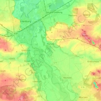
Name: Thallwitz topographic map, elevation, terrain.
Location: Thallwitz, Leipzig, Saxony, Germany (51.38125 12.64429 51.46870 12.83074)
Average elevation: 397 ft
Minimum elevation: 269 ft
Maximum elevation: 564 ft