
Plaza de Armas topographic map
Interactive map
Click on the map to display elevation.
About this map
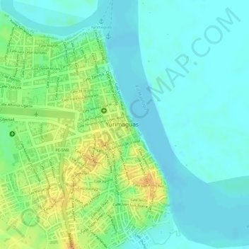
Name: Plaza de Armas topographic map, elevation, terrain.
Location: Plaza de Armas, Yurimaguas, Alto Amazonas, Loreto, Perú (-5.89549 -76.10474 -5.89498 -76.10404)
Average elevation: 449 ft
Minimum elevation: 410 ft
Maximum elevation: 512 ft
Other topographic maps
Click on a map to view its topography, its elevation and its terrain.
Huallaga
Perú > Loreto > Yurimaguas
Huallaga, Yurimaguas, Alto Amazonas, Loreto, Perú
Average elevation: 397 ft