
Berga topographic map
Interactive map
Click on the map to display elevation.
About this map
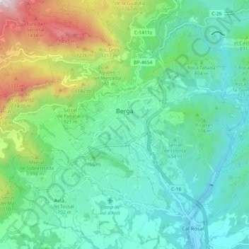
Name: Berga topographic map, elevation, terrain.
Location: Berga, Berguedà, Barcelona, Cataluña, 08600, España (42.07109 1.79901 42.12394 1.88774)
Average elevation: 2,569 ft
Minimum elevation: 1,562 ft
Maximum elevation: 5,597 ft