
La Codosera topographic map
Interactive map
Click on the map to display elevation.
About this map
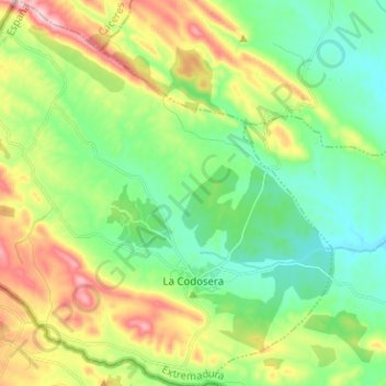
Name: La Codosera topographic map, elevation, terrain.
Location: La Codosera, Tierra de Badajoz, Badajoz, Estrémadure, Espagne (39.18043 -7.24802 39.27826 -7.12813)
Average elevation: 1,211 ft
Minimum elevation: 892 ft
Maximum elevation: 1,834 ft