Geolocate

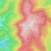
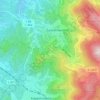
Oppenau topographic map

Click on the map to display elevation.

About this map
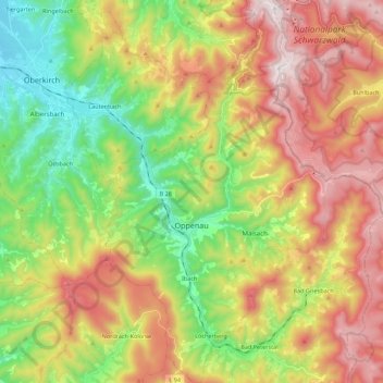
Name: Oppenau topographic map, elevation, terrain.

Location: Oppenau, Verwaltungsverband Oberes Renchtal, Ortenaukreis, Baden-Württemberg, 77728, Germany (48.41480 8.11485 48.56101 8.24224)

Average elevation: 1,870 ft

Minimum elevation: 574 ft

Maximum elevation: 3,458 ft

Other topographic maps

Click on a map to view its topography, its elevation and its terrain.

Sommerseite

Germany > Baden-Württemberg > Ortenaukreis > Seebach

Average elevation: 1,965 ft

Kernhof

Germany > Baden-Württemberg > Ortenaukreis > Seebach

Average elevation: 2,477 ft

Schliffkopf

Germany > Baden-Württemberg > Ortenaukreis > Oppenau

Average elevation: 2,835 ft

Waldulm

Germany > Baden-Württemberg > Ortenaukreis

Average elevation: 942 ft

Obergieß

Germany > Baden-Württemberg > Ortenaukreis > Hornberg > Niederwasser

Average elevation: 2,352 ft
Hilsenhof

Germany > Baden-Württemberg > Ortenaukreis > Seebach

Average elevation: 1,736 ft

Gear up for your next adventure:

🧣Merino Neck Gaiters - Multi-functional headwear for wind and sun protection
🧯Portable Fire Pit - Compact fire pit for camping spots
🔥Fast-Boil Camping Stoves - Efficient cooking systems for quick trail meals
🥤Water Filter Bottle - All‑in‑one filter bottle for safe hydration
🩳Quick‑Dry Hiking Shorts - Comfortable and quick‑dry shorts for summer hiking

As an Amazon Associate, this site earns from qualifying purchases at no extra cost to you.