
Pflersch topographic map
Interactive map
Click on the map to display elevation.
About this map
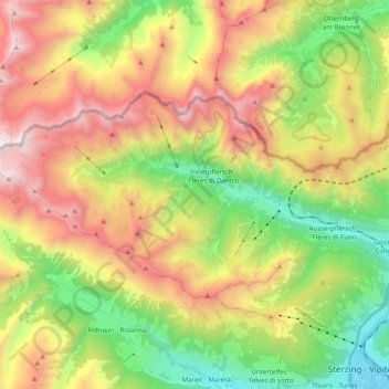
Name: Pflersch topographic map, elevation, terrain.
Average elevation: 6,250 ft
Minimum elevation: 3,084 ft
Maximum elevation: 10,331 ft
Other topographic maps
Click on a map to view its topography, its elevation and its terrain.
Rotspitze
Italien > Trentino-Südtirol > Brenner
Rotspitze, Brenner, Wipptal, Bozen, Trentino-Südtirol, Italien
Average elevation: 7,106 ft