
Hatta Hill Park topographic map
Interactive map
Click on the map to display elevation.
About this map
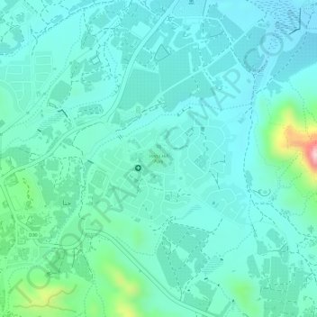
Name: Hatta Hill Park topographic map, elevation, terrain.
Location: Hatta Hill Park, Hatta, Dubai, United Arab Emirates (24.80002 56.12783 24.80251 56.13071)
Average elevation: 1,096 ft
Minimum elevation: 938 ft
Maximum elevation: 1,729 ft
Other topographic maps
Click on a map to view its topography, its elevation and its terrain.
Hatta
United Arab Emirates > Dubai > Hatta
Hatta, Dubai, United Arab Emirates
Average elevation: 1,424 ft
Hatta
United Arab Emirates > Dubai > Hatta
Hatta, Dubai, United Arab Emirates
Average elevation: 1,385 ft