
Buğralar topographic map
Interactive map
Click on the map to display elevation.
About this map
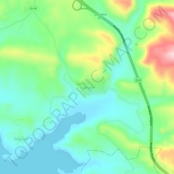
Name: Buğralar topographic map, elevation, terrain.
Location: Buğralar, Çamlıdere, Ankara, Central Anatolia Region, Turkey (40.39589 32.39884 40.43589 32.43884)
Average elevation: 3,399 ft
Minimum elevation: 3,133 ft
Maximum elevation: 4,042 ft
Other topographic maps
Click on a map to view its topography, its elevation and its terrain.
Buğralar Yaylası
Buğralar Yaylası, Çamlıdere, Ankara, Central Anatolia Region, Turkey
Average elevation: 5,043 ft