
Quepe topographic map
Interactive map
Click on the map to display elevation.
About this map
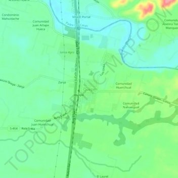
Name: Quepe topographic map, elevation, terrain.
Average elevation: 292 ft
Minimum elevation: 200 ft
Maximum elevation: 509 ft
Other topographic maps
Click on a map to view its topography, its elevation and its terrain.
Radal
Chile > Región de la Araucanía > Provincia de Cautín > Freire > Radal
Radal, Freire, Provincia de Cautín, Región de la Araucanía, Chile
Average elevation: 571 ft