
野洞河镇 topographic map
Interactive map
Click on the map to display elevation.
About this map
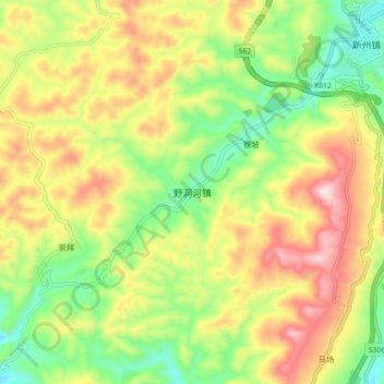
Name: 野洞河镇 topographic map, elevation, terrain.
Location: 野洞河镇, 黄平县, 黔东南苗族侗族自治州, 贵州省, 中国 (26.83193 107.81737 26.91193 107.89737)
Average elevation: 3,140 ft
Minimum elevation: 2,431 ft
Maximum elevation: 4,012 ft
Other topographic maps
Click on a map to view its topography, its elevation and its terrain.